Maps
Don Brenneis sent this map on silk. He got it from a friend whose father was a career Navy pilot and had flown in the South Pacific. This was part of the survival kit for flyers who could be shot down and it shows winds and currents.
FOTI is working on a better reproduction. |
|
Steve Tripp sent this new image of Tobi from Google Earth..
|
|
 Fold out map from Nanyo Kohatsu Kabushiki Gaisya 20 Syunen (20th Anniversary of Nanyo Kohatsu Corporation), Nanyo Kohatsu Corporation, Tokyo 1941. Larger Version Fold out map from Nanyo Kohatsu Kabushiki Gaisya 20 Syunen (20th Anniversary of Nanyo Kohatsu Corporation), Nanyo Kohatsu Corporation, Tokyo 1941. Larger Version You can find Tobi by following the wide white border of the League of Nations Mandate to the island just before its Southwestern Point. The box with arrow on the left of that island contains no information except that company operations occur there. To the right of that island are the characters for Togobei Hatohobei in Japanese. The map shows shipping lines. Photograph taken by Peter W. Black at Belau National Museum, Koror, 2006. |
|
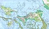
| Palau and its place in the Pacific Ocean | Palau, Helen Reef, Tobi and the Western Pacific U.S. CIA 2004 |
| Palau & Tobi on a map of Southeast Asia U.S. CIA 2004 |
Palau, Helen Reef, Tobi and the Western Pacific U.S. CIA 1995 |
| Republic
of Palau Palau Bureau of Lands and Surveys. |
Aerial
views of Tobi Island
and Helen Reef Developed by Sebastian Marino. |
 |
Helen
Reef Place Names Prepared by D. Sapio, PCV & S. Sakarias, Governor, Hatohobei State. |
| Helen
Reef Soundings in Fathoms U.S. Navy Hydrographic Office 1944. |
|
| Map
of Oceania |
Helen
Reef Year 2000 Monitoring Stations Palau Bureau of Lands and Surveys. |
| Defense
Mapping Agency Chart of Tobi Steven Tripp sent us this scan. |
Helen
Reef Map Community Conservation Network. |
| Relative
Size Comparison of Babeldaob & Helen Reef
Palau Bureau of Lands and Surveys. |

Palau & N.W. New Guinea Ocean Currents Sent by Dave Sapio. |
 USGS
Coastal & Marine Geology Program, Map of the Philippine Sea,
Palau, & Tobi. Steve
Tripp alerted us to this map, too. USGS
Coastal & Marine Geology Program, Map of the Philippine Sea,
Palau, & Tobi. Steve
Tripp alerted us to this map, too. |
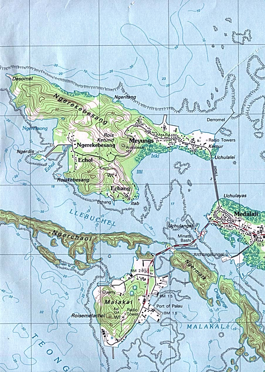
 Topographic map of Koror, Oreor Island, USGS 1983. The
capital city showing Echang and Malakal where
many Tobi people live (large file). The entire map
is a very large file.
Topographic map of Koror, Oreor Island, USGS 1983. The
capital city showing Echang and Malakal where
many Tobi people live (large file). The entire map
is a very large file. |
| A
Navy map showing Tobi & Helen & a reef but not where Transit Reef
should be. . . . Steve Tripp sent this map. .  |
 North Pacific Ocean, J.W. Norie & Co., London 1821, National Library of Australia. Once you zoom in,
you can see Lord North's Island (Tobi) and Helen, called The Helen's
Shoal & Reef. The NLA has the map in an interactive mode so you can zoom in and out where you like. North Pacific Ocean, J.W. Norie & Co., London 1821, National Library of Australia. Once you zoom in,
you can see Lord North's Island (Tobi) and Helen, called The Helen's
Shoal & Reef. The NLA has the map in an interactive mode so you can zoom in and out where you like.The catalogue entry is here. |
| Republic of Palau Outline Map U.S. Bureau of the Census, 1990 |
Palau, 1970 U.S. National Atlas |
| Tobi from above A Landsat image sent by Steve Tripp.  |
 Trust Territory of the Pacific Islands, 1962 TTPI Archives, Map G9405. |

FOTI Home
Updated:
August 21, 2020